News

Computer science grad student Lily Xu holds a wildlife trap and snare that was confiscated by rangers using the PAWS system.
Rangers working in hundreds of wildlife parks in Africa, Asia, and South America will soon have a new tool in the fight against poachers: an artificial intelligence software package.
The Protection Assistant for Wildlife Security (PAWS), developed in the lab of Milind Tambe, Gordon McKay Professor of Computer Science at the Harvard John A. Paulson School of Engineering and Applied Sciences, uses machine learning to predict potential poaching hotspots.
After several years of development, the Tambe Lab has begun launching the system at wildlife parks, with plans to continue refining the software and rolling it out to more than 800 protected areas in more than 60 countries.
Each of these protected areas already uses a database system called SMART, created by the World Wildlife Fund and other conservation organizations, to record observations from ranger patrols—such as the location of an illegal camp site, or the number of wildlife snares found in a certain area, explained computer science graduate student Lily Xu. The lab is now working with the SMART user council to implement PAWS in SMART sites.
“SMART only records historical information. For instance, it can encapsulate the last 10 years of patrol findings. Even though it can be used to query and make maps of where rangers have gone and what they’ve seen, it doesn’t help them do anything analytical or predictive,” she said. “We are trying to fill the gap with our machine learning software.”
PAWS takes that historical data and correlates it to geographical information about the park—how far certain areas are from roads and rivers, the slope of the land, precipitation levels, distance to international borders, wildlife counts—and then builds predictive models based on past poaching activity.
We are very grateful that our PAWS AI software is now transitioning to worldwide use by rangers, and we are grateful for the SMART partnership and our partners in the World Wildlife Fund, Wildlife Conservation Society, and the other organizations that are part of SMART. It is very rewarding to use our science to assist rangers in their work; they are putting their lives on the line to preserve wildlife around the world.
The software produces a map that breaks a park down into squares—the default is 1 kilometer by 1 kilometer—and predicts the likelihood there will be poaching activity in each square.
“The challenge is that we are working with very large parks and relatively scarce data. Even though rangers may have been patrolling a park for more than 10 years, they might only focus their efforts on certain areas, so some parts of the park are completely unexplored,” she said. “And if rangers patrol a certain area and don’t find anything, we don’t know for certain that there actually wasn’t any poaching activity there. That poses a big challenge from a data science perspective.”
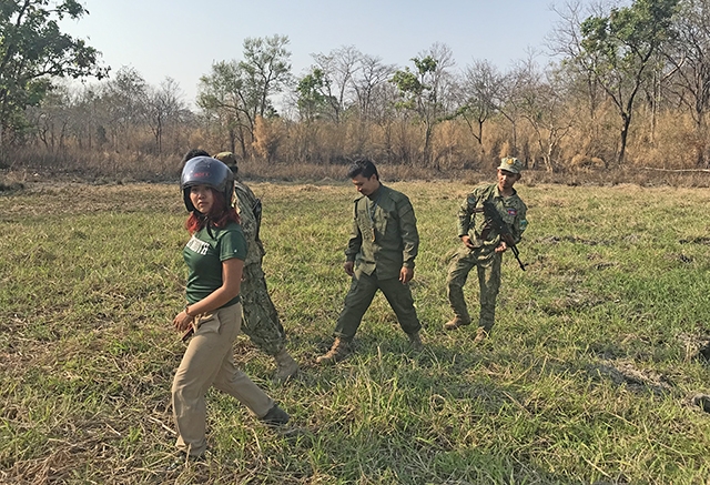
Xu with a group of rangers on patrol.
For rangers on the ground, the information PAWS generates can be used in different ways. They could reference the map as they manually plan patrols, or they can use the software to zero in on high-risk areas that include certain criteria, such as proximity to a river.
For instance, rangers at a park in Cambodia who piloted the software used it to generate 16 hotspots they built into their monthly patrols; each of the four ranger teams is responsible for visiting four areas, Xu explained.
Now that additional parks are implementing the software, new practical challenges are arising.
Internet connections are rare in some game preserves, and others have such limited computing power that it would be nearly impossible to run the machine learning algorithms. To alleviate this issue, the team partnered with Microsoft’s AI for Earth program to provide cloud computing support through Azure. Processing queries in Azure and sending poaching predictions back to users makes the PAWS system more practical for a wide range of parks to use.
The team is currently implementing the system in six parks that have more robust technical capabilities. The lessons learned in those sites will inform the rollout to parks with fewer resources. These initial tests will be followed by a worldwide rollout that will see the PAWS software implemented in more than 800 parks.
“We are really curious to understand how these predictive algorithms can be most useful to parks that have this wide array of different wildlife protection needs based on the terrain of the park, the resources the park has, whether or not vehicles are available, and so many other factors,” she said. “We are trying to figure out, given these challenges, how we can adapt to them and either change the way we are generating predictions or modify the way that we are helping them make decisions.”
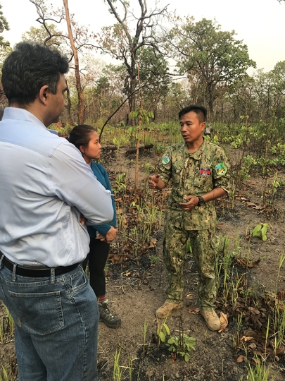
Tambe and Xu speak with with Ly Bora, Deputy Director of Srepok Wildlife Sanctuary in Cambodia.
Early tests have shown that the software holds a lot of promise to help rangers reduce poaching. During beta tests at a Cambodian park in December, 2018, rangers using PAWS predictions to patrol were able were able to find and remove more than five times as many snares as usual.
While those results are exciting, Xu emphasizes that the software is meant to complement the work of skilled rangers so they can be more efficient with limited resources. For instance, the Cambodian park where they beta tested is roughly the size of Rhode Island, but only has a staff of 72 rangers.
Rangers also face different types of poachers. In one park in Malaysia, for instance, songbird poachers focus on one area of the park, while big game poachers can be found in a different area, and bushmeat poachers operate in a third location. All of this poaching activity happens at different times based on seasonal factors.
“By accounting for the dynamism of all these different factors, we are better able to provide the rangers with useful information,” Xu said. “But the AI solution is not a complete solution. This software is not making decisions for rangers on where they patrol. But our algorithm will point out, perhaps these are areas you’ve been neglecting in recent months that it might be worth visiting. This is more of a decision aid than a decision maker.”
Xu is looking forward to incorporating more feedback from the rangers on the ground into the software as she and the team expand the implementation. The team also plans to incorporate in PAWS advanced game-theory algorithms to help plan patrol routes more carefully, transitioning this new capability from the lab to the field.
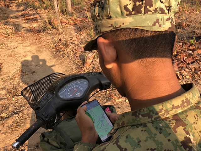
A ranger on a motorbike patrol looks at a map and records GPS waypoints.
One of the things she’s enjoyed most about this process has been working so closely with rangers; she traveled in February, 2019 to Cambodia, where she joined rangers on a motorbike patrol. Experiencing their practical challenges firsthand, and seeing how they apply their unique skills in a complex environment, has inspired Xu to double-down on this effort.
“Realizing all the challenges they have in this domain was eye-opening for me,” she said. “It’s been inspiring to work with them, and it has shown me that we can use our computational skills to address these challenges that can really make a difference in the world.”
“We are very grateful that our PAWS AI software is now transitioning to worldwide use by rangers, and we are grateful for the SMART partnership and our partners in the World Wildlife Fund, Wildlife Conservation Society, and the other organizations that are part of SMART,” Tambe said. “It is very rewarding to use our science to assist rangers in their work; they are putting their lives on the line to preserve wildlife around the world.”
Established in 2011, the SMART Partnership has become the global leader in protected area management solutions, offering an integrated suite of powerful tools and services to help conservation practitioners improve management effectiveness and better protect wildlife. Current SMART Partnership members are: Frankfurt Zoological Society, Global Wildlife Conservation, North Carolina Zoo, Panthera, Peace Parks Foundation, Wildlife Conservation Society, Wildlife Protection Solutions, World Wildlife Fund, and Zoological Society of London.
Topics: AI / Machine Learning, Computer Science
Cutting-edge science delivered direct to your inbox.
Join the Harvard SEAS mailing list.
Scientist Profiles

Milind Tambe
Gordon McKay Professor of Computer Science
Press Contact
Adam Zewe | 617-496-5878 | azewe@seas.harvard.edu